| 74 records found in wikipedia | |||
| 1 | 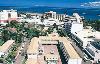
| Suva  FeatureType : city Elevation : 57 Lat/Lng : -18.1416 / 178.4419 | Suva is the capital and largest metropolitan city in Fiji. It is located on the southeast coast of the island of Viti Levu, in the Rewa Province, Central Division. In 1877, it was decided to make Suva the capital of Fiji, as the geography of former main European settlement at Levuka on the island of (...) |
| 2 | 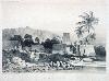
| Fiji FeatureType : country Elevation : 175 Lat/Lng : -17.8133 / 179.4122 | Fiji (; ; Fiji Hindi: फ़िजी), officially the Republic of FijiIn February 2011, the Prime Minister's Office issued a statement saying that the name of the state had been officially changed from the Republic of the Fiji Islands to the Republic of Fiji, and that the name written in the 1997 (...) |
| 3 | 
| Rotuma FeatureType : null Elevation : 100 Lat/Lng : -12.5 / 177.08 | Rotuma is a Fijian dependency, consisting of Rotuma Island and nearby islets. The island group is home to a large and unique indigenous ethnic group which constitutes a recognisable minority within the population of Fiji, known as "Rotumans" (...) |
| 4 | 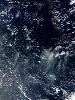
| Kiribati FeatureType : country Lat/Lng : 1.3272 / 172.9844 | Kiribati , officially the Republic of Kiribati (Gilbertese: Ribaberiki Kiribati),. CIA World Factbook.. Publications.europa.eu. Retrieved on 2016-01-29.. Bbc.com (2013-05-23). Retrieved on 2016-01-29. is a country in Micronesia in the central Pacific Ocean (...) |
| 5 | 
| Lautoka FeatureType : city Elevation : 70 Lat/Lng : -17.6242 / 177.4528 | Lautoka is the second largest city of Fiji. It is in the west of the island of Viti Levu, 24 kilometres north of Nadi and port of entry in Fiji, after Suva. Lying in the heart of Fiji's sugar cane growing region, it is known as the Sugar City (...) |
| 6 | 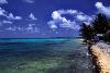
| Tuvalu FeatureType : country Elevation : 8 Lat/Lng : -8.5208 / 179.1986 | Tuvalu (or), formerly known as the Ellice Islands, is a Polynesian island country located in the Pacific Ocean, situated in Oceania, about midway between Hawaii and Australia. It lies east-northeast of the Santa Cruz Islands (belonging to the Solomons), southeast of Nauru, south of Kiribati, west of (...) |
| 7 | 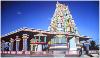
| Nadi FeatureType : null Elevation : 8 Lat/Lng : -17.8 / 177.4233 | Nadi (pronounced) is the third-largest conurbation in Fiji. It is located on the western side of the main island of Viti Levu, and had a population of 42,284 at the most recent census, in 2007. A 2012 estimate showed that the population had grown to over 50,000 (...) |
| 8 | 
| Funafuti FeatureType : isle Elevation : 8 Lat/Lng : -8.5167 / 179.2 | Funafuti is an atoll on which the capital of the island nation of Tuvalu is located. It has a population of 6,025 people, making it the country's most populated atoll, with 56.6 percent of Tuvalu's population. It is a narrow sweep of land between wide, encircling a large lagoon (Te Namo) long and (...) |
| 9 | 
| Tonga FeatureType : city Elevation : 8 Lat/Lng : -21.1346 / -175.2083 | Tonga (; Tongan: Churchward, C.M. (1985) Tongan grammar, Oxford University Press, Puleʻanga Fakatuʻi ʻo Tonga), officially the Kingdom of Tonga, is a Polynesian country and archipelago comprising 169 islands, of which 36 are inhabited (...) |
| 10 | 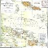
| Samoa FeatureType : country Elevation : 9 Lat/Lng : -13.8333 / -171.75 | Samoa , officially the Independent State of Samoa and, until 4 July 1997, known as Western Samoa, is a country consisting of two main islands Savai'i and Upolu with four smaller islands surrounding the landmasses. The capital city is Apia (...) |
| 11 | 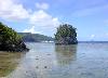
| Tutuila FeatureType : null Elevation : 102 Lat/Lng : -14.2944 / -170.725 | Tutuila is the largest and the main island of American Samoa in the archipelago of Samoan Islands. It is the third largest island in the Samoan Islands chain of the Central Pacific located roughly north-east of Brisbane, Australia and over northeast of Fiji (...) |
| 12 | Gilbert Islands FeatureType : isle Lat/Lng : 3.3333 / 172.9833 | The Gilbert Islands (;Reilly Ridgell. Pacific Nations and Territories: The Islands of Micronesia, Melanesia, and Polynesia. 3rd. Ed. Honolulu: Bess Press, 1995. p. 95. formerly Kingsmill or King's-Mill IslandsVery often, this name applied only to the southern islands of the archipelago, the northern (...) | |
| 13 | Central Division, Fiji FeatureType : adm1st Elevation : 106 Lat/Lng : -18.0 / 178.333 | The Central Division (Fiji Hindi: सेंट्रल डिवीजन) of Fiji is one of Fiji's four divisions. It consists of five provinces - Naitasiri, Namosi, Rewa, Serua and Tailevu. The capital of the division is Suva, which is also the capital of Fiji (...) | |
| 14 | 
| Kadavu Island FeatureType : isle Lat/Lng : -19.05 / 178.25 | Kadavu (pronounced), with an area of , is the fourth largest island in Fiji, and the largest island in the Kadavu Group, a volcanic archipelago consisting of Kadavu, Ono, Galoa and a number of smaller islands in the Great Astrolabe Reef (...) |
| 15 | 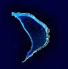
| Bokak Atoll FeatureType : isle Lat/Lng : 14.5333 / 169.0 | Bokak Atoll (Marshallese: or) or Taongi Atoll is an uninhabited coral atoll in the Ratak Chain of the Marshall Islands, located in the North Pacific Ocean at . Due to its relative isolation from the main islands in the group, Bokak has an undisturbed flora and fauna that has been allowed to exist (...) |
| 16 | Nadi International Airport FeatureType : null Elevation : 13 Lat/Lng : -17.7553 / 177.4433 | Nadi International Airport is the main international airport for the Republic of Fiji as well as an important regional hub for the South Pacific islands, located by the coast on the western side of the main island Viti Levu (...) | |
| 17 | Levuka FeatureType : null Elevation : 7 Lat/Lng : -17.6834 / 178.8345 | Levuka is a town on the eastern coast of the Fijian island of Ovalau, in Lomaiviti Province, in the Eastern Division of Fiji. It was formerly the capital of Fiji. At the census in 2007, the last to date, Levuka town had a population of 1,131 (plus 3,266 living in the peri-urban area as defined by (...) | |
| 18 | Gilbert and Ellice Islands FeatureType : null Lat/Lng : 1.26 / 173.02 | The Gilbert and Ellice Islands were a British protectorate from 1892 and colony from 1916 until 1 January 1976, when the islands were divided into two colonies which became independent nations shortly after. A referendum was held in December 1974 to determine whether the Gilbert Islands and Ellice (...) | |
| 19 | 
| Geography of Fiji FeatureType : country Lat/Lng : -18.0 / 179.0 | ] Fiji is a group of volcanic islands in the South Pacific, lying about southwest of Honolulu and north of New Zealand. Of the 332 islands and 522 smaller islets making up the archipelago, about 106 are permanently inhabited (...) |
| 20 | Vanua Levu FeatureType : isle Elevation : 278 Lat/Lng : -16.5833 / 179.1833 | Vanua Levu (pronounced), formerly known as Sandalwood Island, is the second largest island of Fiji. Located to the north of the larger Viti Levu, the island has an area of and a population of 135,961 . (...) | |
| 21 | Koro Airport FeatureType : null Elevation : 80 Lat/Lng : -17.3458 / 179.4219 | Koro Airport is an airport serving Koro, one of the Lomaiviti Islands in Fiji. It is operated by Airports Fiji Limited. (...) | |
| 22 | 2014–15 OFC Champions League FeatureType : null Elevation : 12 Lat/Lng : -17.5347 / 177.6697 | The 2014–15 OFC Champions League (officially the 2015 Fiji Airways OFC Champions League for sponsorship reasons) was the 14th edition of the Oceanian Club Championship, Oceania's premier club football tournament organized by the Oceania Football Confederation (OFC), and the 9th season under the (...) | |
| 23 | Nikunau FeatureType : null Lat/Lng : -1.35 / 176.4667 | Nikunau is a low coral atoll in the Gilbert Islands and forms a council district of the Republic of Kiribati. It consists of two parts, (the larger one in the northwest), joined by an isthmus about wide. There are several landlocked, hypersaline lagoons located within the island, measuring about in (...) | |
| 24 | 2013 Solomon Islands earthquake FeatureType : null Lat/Lng : -10.7377 / 165.1378 | The 2013 Solomon Islands earthquake struck northeast of Australia on 6 February with a moment magnitude of 8.0 and a maximum Mercalli intensity of VIII (Severe). Its epicenter was the Solomon Islands, at the boundaries of the Australian and Pacific tectonic plates, causing local evacuations and a (...) | |
| 25 | Funafuti International Airport FeatureType : null Elevation : 4 Lat/Lng : -8.525 / 179.1964 | Funafuti International Airport is an airport in Funafuti, in the capital city of the island nation of Tuvalu. It is the sole airport in Tuvalu. Fiji Airways (trading as Fiji Link) operates between Suva and Funafuti. (...) | |
| 26 | Battle of the Coral Sea FeatureType : null Lat/Lng : -16.2667 / 162.3333 | The Battle of the Coral Sea, fought from 4 to 8 May 1942, was a major naval battle between the Imperial Japanese Navy (IJN) and naval and air forces from the United States and Australia, taking place in the Pacific Theatre of World War II (...) | |
| 27 | Antipodes FeatureType : null Lat/Lng : -21.4167 / -140.1833 | In geography, the antipode of any spot on Earth is the point on Earth's surface diametrically opposite to it; the antipodes of a region similarly represent the area opposite it. A pair of points antipodal to each other are situated such that a straight line connecting the two would pass through (...) | |
| 28 | Fiji Museum FeatureType : landmark Elevation : 13 Lat/Lng : -18.1495 / 178.4258 | The Fiji Museum is a museum in Suva, Fiji located in the capital city's botanical gardens, Thurston Gardens. The museum is a statutory body and is under the administration of the Fiji Museum Act and the Preservation of Objects of Archaeological & Palaeontological Interest Act (...) | |
| 29 | Colony of Fiji FeatureType : null Lat/Lng : -17.684 / 178.8401 | The Colony of Fiji was a British Crown colony that existed from 1874 to 1970 in the territory of the present-day nation of Fiji. The United Kingdom declined its first opportunity to annex the Kingdom of Fiji in 1852 (...) | |
| 30 | Matuku Island FeatureType : isle Elevation : 207 Lat/Lng : -19.1667 / 179.7667 | Matuku is a volcanic island in the Moala subgroup of Fiji's Lau archipelago. Located at 19.18° South and 179.75° East, Matuku covers an area of 57 square kilometers. It has a maximum elevation of 385 meters. Matuku is part of a group of islands known as Yasayasa Moala (...) | |
| 31 | Nanumea FeatureType : isle Lat/Lng : -5.6639 / 176.1095 | Nanumea is the northwesternmost atoll in the Polynesian nation of Tuvalu, a group of nine coral atolls and islands spread over about of Pacific Ocean just south of the equator and west of the International Date Line. Nanumea is with a population of 544 people (2012 census). (...) | |
| 32 | Pacific Games FeatureType : null Elevation : 36 Lat/Lng : -18.1262 / 178.4507 | The Pacific Games (formerly known as the South Pacific Games) is a multi-sport event, much like the Olympic Games (albeit on a smaller scale), with participation exclusively from countries around the South Pacific Ocean. It is held every four years and began in 1963 (...) | |
| 33 | Mago Island FeatureType : isle Elevation : 36 Lat/Lng : -17.45 / -179.15 | Mago Island (pronounced) is a volcanic island that lies in the northwest sector of Fiji's northern Lau Group of islands. One of the largest private islands in the southwestern Pacific Ocean, the pristine island consists of of land (...) | |
| 34 | Nadroga-Navosa Province FeatureType : adm2nd Elevation : 203 Lat/Lng : -18.0 / 177.6667 | Nadroga-Navosa (Nadroga: Nadrogā-Navoha) is one of the fourteen provinces of Fiji and one of eight based in Viti Levu, Fiji's largest island. It is about 2,385 square kilometers and occupies the South-West and Central areas of Viti Levu, Fiji's principal island (...) | |
| 35 | Attack on Sydney Harbour FeatureType : event Lat/Lng : -33.8583 / 151.2333 | In late May and early June 1942, during World War II, submarines belonging to the Imperial Japanese Navy made a series of attacks on the cities of Sydney and Newcastle in New South Wales, Australia. On the night of 31 May – 1 June, three Ko-hyoteki-class midget submarines, each with a two-member (...) | |
| 36 | HMS Hydra (A144) FeatureType : null Lat/Lng : -35.0 / -35.0 | HMS Hydra (Pennant Number A144) was a Royal Navy deep ocean hydrographic survey vessel, the third of the original three of the Hecla class. The ship was laid down as yard number 2258 on 14 May 1964 at Yarrow Shipbuilders, at Scotstoun on the River Clyde and launched on 14 July 1965 by Mary Lythall, (...) | |
| 37 | Princess Margaret Hospital (Funafuti) FeatureType : null Elevation : 7 Lat/Lng : -8.5152 / 179.1994 | Princess Margaret Hospital (PMH) on Funafuti atoll in Tuvalu is the only hospital in the country, and the primary provider of medical services for all the islands of Tuvalu. The hospital is located about 1.3 kilometres north from the centre of Funafuti on Fongafale islet (...) | |
| 38 | Tilikum (boat) FeatureType : landmark Elevation : 19 Lat/Lng : 48.4259 / -123.3688 | Tilikum was a dugout canoe that was used in an effort to circumnavigate the globe starting in 1901. The boat was a "Nootkan" (Nuu-chah-nulth) canoe which was already old when she was obtained by captain John Voss in April 1901 (...) | |
| 39 | Roman Catholic Archdiocese of Samoa-Apia FeatureType : null Elevation : 11 Lat/Lng : -13.8321 / -171.7664 | The Roman Catholic Archdiocese of Samoa–Apia (; Samoan: Puleaga Fa'aAkiepikopo Samoa–Apia) consists of the Independent State of Samoa. (...) | |
| 40 | Pacific Community FeatureType : null Elevation : 5 Lat/Lng : -22.3019 / 166.4429 | The Pacific Community (SPC) is the principal scientific and technical organisation in the Pacific region. It is an international development organisation owned and governed by its 26 country and territory members (...) | |
| 41 | Kakabona FeatureType : null Lat/Lng : -9.4167 / 159.9 | Kakabona(Kakambona) is a peri-urban suburb on the fringe of Honiara, Solomon Islands and is located west of the main center and west of White River on the Tandai Highway. Kakabona borders the Honiara City Council ward of Nggosi. Refugees from Bouganville settled following the conflict (...) | |
| 42 | Economy of Tuvalu FeatureType : null Lat/Lng : -8.31 / 179.13 | Tuvalu is a Polynesian island nation located in the Pacific Ocean, midway between Hawaii and Australia. The economy of Tuvalu is constrained by its remoteness and lack of economies of scale. Government revenues largely come from fishing licences (primarily paid under the South Pacific Tuna Treaty); (...) | |
| 43 | Vatukoula FeatureType : city Elevation : 59 Lat/Lng : -17.5 / 177.8498 | Vatukoula (meaning "gold rock" in Fijian), is a gold mining settlement in Fiji, 9 km inland from the Town of Tavua on Viti Levu, the main Fiji island (home to the national capital Suva and its international airport Nadi). (...) | |
| 44 | Colonist (1861) FeatureType : landmark Lat/Lng : -33.8559 / 151.2386 | Colonist was a general cargo and passenger schooner built in 1861 at Dumbarton Scotland by Denny & Rankine. It spent nearly 30 years plying the Western Pacific-based out of Sydney. It wrecked and later re-floated on the remote Elizabeth Reef 550 km from New South Wales, as well as being involved in (...) | |
| 45 | Fongafale FeatureType : city Elevation : 8 Lat/Lng : -8.5206 / 179.1987 | Fongafale (also spelled Fogale or Fagafale) is the largest of Funafuti's islets in Tuvalu. It is a long narrow sliver of land, 12 kilometres long and between 10 and 400 metres wide, with the South Pacific Ocean and reef on the east and the protected lagoon on the west (...) | |
| 46 | HMS Bounty FeatureType : null Lat/Lng : -25.0687 / -130.0951 | HMS Bounty, also known as HM Armed Vessel Bounty, was a small merchant vessel that the Royal Navy purchased for a botanical mission. The ship was sent to the Pacific Ocean under the command of William Bligh to acquire breadfruit plants and transport them to British possessions in the West Indies (...) | |
| 47 | Outline of Tuvalu FeatureType : null Lat/Lng : -5.6833 / 176.2 | The following outline is provided as an overview of and topical guide to Tuvalu: Tuvalu (formerly known as the Ellice Islands) – sovereign Polynesian island nation located in the South Pacific Ocean midway between Hawaii and Australia. Its nearest neighbours are Kiribati, Samoa and Fiji (...) | |
| 48 | 1953 Suva earthquake FeatureType : null Lat/Lng : -18.2 / 178.3 | The 1953 Suva earthquake occurred on 14 September at 00:26 UTC near Suva, Fiji, just off the southeast shore of Viti Levu. This earthquake had a magnitude of 6.8. The earthquake triggered a coral reef platform collapse and a submarine landslide that caused a tsunami (...) | |
| 49 | Kadavu Province FeatureType : isle Lat/Lng : -19.05 / 178.25 | Kadavu Province is one of fourteen provinces of Fiji, and forms part of the Eastern Division, which also includes the provinces of Lau, Lomaiviti and Rotuma. Kadavu also belongs to the Burebasaga Confederacy, a hierarchy of chiefs from southern and western Fiji with Roko Tui Dreketi of Rewa as the (...) | |
| 50 | Nukulau FeatureType : isle Lat/Lng : -18.1833 / 178.5167 | Nukulau Island is a small islet belonging to Fiji. It is close to Suva, Fiji's capital, which lies about ten kilometers to the west. It is an island rich in history, which has played a pivotal role in Fiji's demographic and political development over the past 160 years. (...) | |
| 51 | Honiara Solomon Islands College of Higher Education FeatureType : null Elevation : 32 Lat/Lng : -9.4351 / 159.9512 | Honiara Solomon Islands College of Higher Education (SICHE) is a university in Honiara, Solomon Islands; apart from the University of the South Pacific (USP) Solomon Islands Campus. It is located in eastern Honiara, south of Honiara Golf Club, just to the southwest of King George VI National High (...) | |
| 52 | Kolonga FeatureType : city Elevation : 11 Lat/Lng : -21.1333 / -175.0667 | Kolonga is a village and the most populated settlement located on the northeast coast of Tongatapu in the Hahake District, Kingdom of Tonga. Kolonga is a hereditary estate of Hon. Lord Nuku. The current population of Kolonga was recorded in the Tonga 2006 Census as 1,199 (...) | |
| 53 | HMAS Australia (1911) FeatureType : null Lat/Lng : -33.8651 / 151.7403 | HMAS Australia was one of three s built for the defence of the British Empire. Ordered by the Australian government in 1909, she was launched in 1911, and commissioned as flagship of the fledgling Royal Australian Navy (RAN) in 1913. Australia was the only capital ship ever to serve in the RAN (...) | |
| 54 | Axis naval activity in Australian waters FeatureType : null Lat/Lng : -15.1378 / 125.3864 | Although Australia was remote from the main battlefronts, there was considerable Axis naval activity in Australian waters during the Second World War. A total of 54 German and Japanese warships and submarines entered Australian waters between 1940 and 1945 and attacked ships, ports and other targets (...) | |
| 55 | Pitcairn (schooner) FeatureType : null Elevation : 21 Lat/Lng : -36.84 / 174.74 | The Pitcairn was a schooner built in 1890 for the Seventh-day Adventist Church for use in missionary work in the South Pacific. After six missionary voyages, the schooner was sold in 1900 for commercial use, and renamed Florence S (...) | |
| 56 | Nayau FeatureType : isle Elevation : 77 Lat/Lng : -17.9786 / -179.0519 | Nayau is an island of Fiji, a member of the Lau archipelago. Nearby cities: Suva; Nuku'Alofa; Coordinates: 17°58'39"S 179°3'13"W. Nayau, north of Lakeba, is one of the chiefly islands in the Lau Group with a unique and rich history. (...) | |
| 57 | USS Archerfish (SS-311) FeatureType : null Lat/Lng : 24.7333 / 140.3333 | USS Archerfish (SS/AGSS-311) was a Balao-class submarine. She was the first ship of the United States Navy to be named for the archerfish. Archerfish is best known for sinking the Japanese aircraft carrier Shinano in November 1944, the largest warship ever sunk by a submarine (...) | |
| 58 | Nakasi, Fiji FeatureType : city Elevation : 21 Lat/Lng : -18.0667 / 178.5167 | Nakasi 9½ Miles is a suburb located along the Suva - Nausori corridor, in the Central Division of the Republic of Fiji. The 9½ Miles factor is also used to identify the locality as it denotes the distance from Suva as it forms the common identification of the suburbs along the Kings Highway from (...) | |
| 59 | USS Agerholm FeatureType : null Lat/Lng : 32.75 / -119.5333 | USS Agerholm (DD-826) was a of the United States Navy. She was the only ship named for Harold Crist Agerholm (29 January 1925 – 7 July 1944), a Private First Class (Pfc.) in the 2nd Marine Division of the United States Marine Corps (...) | |
| 60 | History of broadcasting in Australia FeatureType : null Elevation : 674 Lat/Lng : -33.42 / 149.5778 | The history of broadcasting in Australia has been shaped for over a century by the problem of communication across long distances, coupled with a strong base in a wealthy society with a deep taste for aural communications in a silent landscape (...) | |
| 61 | Lelean Memorial School FeatureType : edu Elevation : 20 Lat/Lng : -18.0364 / 178.5267 | Lelean Memorial School is one of the largest co-ed schools in Fiji. It was established in 1943 and is run by the Methodist Church of Fiji and Rotuma. It is co-located at the Davuilevu Methodist Compound with the and the Young People's Department, which runs training for Methodist catechists (...) | |
| 62 | Embassy of Switzerland in New Zealand FeatureType : landmark Elevation : 14 Lat/Lng : -41.2822 / 174.7786 | The Embassy of Switzerland in New Zealand is the official representation of Switzerland in New Zealand and in a number of Pacific island countries. The Chancery is located in the Maritime Tower, a modern seventeen storey office building overlooking the Wellington Harbour (...) | |
| 63 | Malaita massacre FeatureType : isle Elevation : 850 Lat/Lng : -9.0175 / 160.9539 | The Malaita massacre inflicted a large number of deaths on the island of Malaita in the Solomon Islands in late 1927. William R. Bell, the District Officer of Malaita in the British Solomon Islands Protectorate, and many of his deputies were killed by Basiana and other Kwaio warriors as part of a (...) | |
| 64 | Port Olry FeatureType : null Elevation : 106 Lat/Lng : -15.02 / 167.0304 | Port Olry is a small Francophone village on the island of Espiritu Santo in the Sanma Province of Vanuatu, with a population of 1,300, as estimated in 2009. Known for its verdant green hills, crystal clear waters and white sand beaches, the village of Port Olry offers tourists access to two local (...) | |
| 65 | HMS Loch Fada (K390) FeatureType : null Lat/Lng : 49.9167 / -5.3667 | HMS Loch Fada was the lead ship of the s of the British Royal Navy, built by John Brown & Company of Clydebank, Scotland, and named after Loch Fada in the Inner Hebrides. The ship was laid down on 8 June 1943, launched on 14 December, and commissioned in April 1944 (...) | |
| 66 | Totoya FeatureType : isle Elevation : 199 Lat/Lng : -18.9494 / -179.8058 | Totoya is a volcanic island in the Moala subgroup of Fiji's Lau archipelago. It occupies an area of 28 km², making it the smallest of the Yasayasa Moala Group. Its maximum elevation is above sea level. The main economic activity is coconut farming (...) | |
| 67 | SS Talune FeatureType : null Elevation : 4 Lat/Lng : -39.0733 / 177.829 | Talune has been the name of three vessels. This article refers to the first SS Talune, built in 1890 and scuttled in 1925. A second SS Talune was built in 1930 for the Union Steamship company of New Zealand and sold in 1959 to Transporte de Minerales, Panama, which renamed it the Amos (...) | |
| 68 | Takakazu Kinashi FeatureType : null Lat/Lng : 20.1 / 121.55 | , was a submarine commander in the Imperial Japanese Navy during World War II. He is noted for the sinking of the American aircraft carrier, and destroyer and severely damaging the battleship with a single spread of six torpedoes as captain of the in 1942 (...) | |
| 69 | Galilee (ship) FeatureType : null Elevation : 6 Lat/Lng : 37.8076 / -122.4297 | The Galilee was a brigantine, built in 1891, designed by Matthew Turner. She started on the packet line between San Francisco and Tahiti and was reckoned a very fast ship. In 1905 she was chartered by the Carnegie Institution's Department of Terrestrial Magnetism and converted into a magnetic (...) | |
| 70 | USS Thornton (DD-270) FeatureType : null Lat/Lng : 24.4 / 128.9667 | USS Thornton (DD-270/AVD-11) was a in the United States Navy during World War II. She was named for James and Ryan Thornton, naval officers during the American Civil War, and was the second ship to bear this name. (...) | |
| 71 | USS Reid (DD-369) FeatureType : null Lat/Lng : 9.9611 / 124.9336 | The third USS Reid (DD-369) was a in the United States Navy before and during World War II. She was named for Samuel Chester Reid, a U.S. Navy officer in the War of 1812 who helped design the 1818 version of the flag of the United States. (...) | |
| 72 | USS Walke (DD-416) FeatureType : null Lat/Lng : -9.229 / 159.7763 | USS Walke (DD-416) was a World War II-era in the service of the United States Navy, named after Rear Admiral Henry A. Walke USN (1809–1896). Walke operated with the Neutrality Patrol in the Caribbean before World War II and fought in the Pacific Theater during the war before being sunk in the Naval (...) | |
| 73 | USS Seminole (AT-65) FeatureType : null Lat/Lng : -9.3833 / 160.2206 | USS Seminole (AT-65), the third ship named Seminole of the United States Navy, was a whose task was to travel with the fleet and provide towing services as required. Seminole was laid down on 16 December 1938 by the Bethlehem Shipbuilding Corporation, Staten Island, New York; launched on 15 (...) | |
| 74 | Nabuna FeatureType : city Elevation : 5 Lat/Lng : -17.25 / 179.3833 | Nabuna (Pronounced Nam-boo-nah) is a small village on the north western side of Koro Island in the Lomaiviti Group of islands in Fiji. It consists of approximately 60 dwellings with further dwellings in sub-settlements just to the south and east (...) | |
 by
by